2024 Map of Parkin
USGS Topo · Published 2024About this map
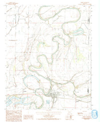
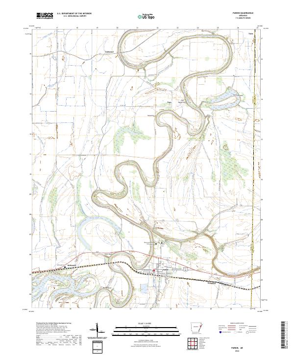
The Saint Francis River dominates the Arkansas Delta landscape on this map, winding in dramatic oxbows through Cross Co and Crittenden Co. At the heart of this alluvial plain lies Parkin, where the Parkin Archeological State Park Cem preserves a site of significant pre-colonial and early regional history. The settlement pattern reflects the area's agricultural and river-dependent roots, with smaller communities like Smithdale, McDonald, and the curious locality of Twist scattered across the level terrain.
Find a feature on this map
61 named features on this map. Tap any name to fly to it.
Don’t see what you’re looking for? This feature index may not catch every label — zoom into the map to look around manually.
Map Details
Editions of this 2024 Parkin Map
This is the sole edition of this map. No revisions or reprints were ever made.