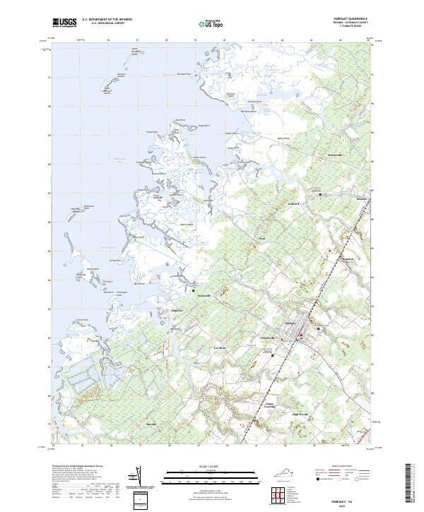
2022 Map of Parksley
USGS Topo · Published 2022About this map
The town of Parksley serves as a central hub on Virginia's Eastern Shore, surrounded by a landscape of tidal marshes and historic farming settlements. This coastal area is defined by its complex shoreline along the Chesapeake Bay, where features like Beasley Bay and The Thorofare weave between a network of islands including Marks Island and the Bernard Islands. The map reveals a high concentration of local history markers, particularly several family and community burial grounds such as the Abrams Family Cem and Liberty Cem, which sit alongside established congregations like the Guilford Methodist Church Cem.
Find a feature on this map
150 named features on this map. Tap any name to fly to it.
Don’t see what you’re looking for? This feature index may not catch every label — zoom into the map to look around manually.
Map Details
Editions of this 2022 Parksley Map
This is the sole edition of this map. No revisions or reprints were ever made.
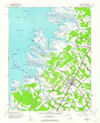
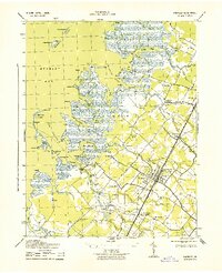
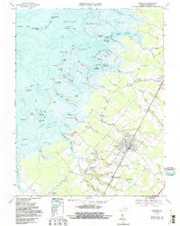
Historical Maps of Parksley Through Time
4 maps found