2023 Map of Parma
USGS Topo · Published 2023About this map
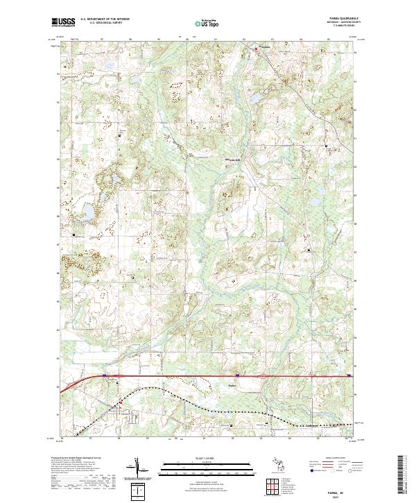
Sandstone Creek and Mackey Brook wind through this part of Jackson County, shaping a landscape defined by traditional rural Michigan settlements and scattered family cemeteries. The village of Parma sits as a central hub, where the path of Railroad St and major thoroughfares intersect. North of the village, the small settlement of Minards Mill suggests an earlier era of local industry tied to the area's watercourses. The map is particularly notable for its density of burial grounds, providing a detailed record for genealogical research through sites such as Fairview Cem, Lincoln Pomeroy Cem, and Upton Cem. In the north, Tompkins serves as another focal point for the surrounding agricultural community, which is connected by a grid of family-named roads like Gordon Rd and Wellman Rd.
Find a feature on this map
73 named features on this map. Tap any name to fly to it.
Don’t see what you’re looking for? This feature index may not catch every label — zoom into the map to look around manually.
Map Details
Editions of this 2023 Parma Map
This is the sole edition of this map. No revisions or reprints were ever made.
Historical Maps of Parma Through Time
Featured Locations
- Parma, MI
- Springport Township, MI
- Tompkins Township, MI
- Minard's Mill, Tompkins Township
- Tompkins, Tompkins Township