2024 Map of Peerless
USGS Topo · Published 2024About this map
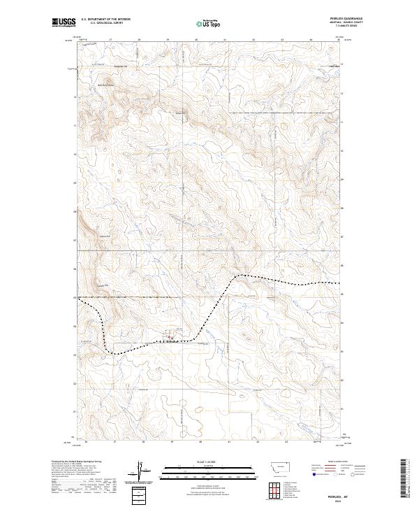
Peerless serves as the central hub of this northern Montana landscape, located along the grid of local thoroughfares like Offett St and 3rd Ave. The map documents a classic Great Plains terrain characterized by drainage coulees and isolated high points. Significant landmarks include Slaughter Hill to the north and the cluster of Wild Horse Butte, Jones Hill, and Sundby Hill which punctuate the prairie. Water movement through this semi-arid region is traced by Police Creek and Olson Coulee, while the presence of a Po in Peerless marks the community's role as a local service point. The extensive road network, including Peerless Lustre Rd and Butte Creek Rd, illustrates the organized township-and-range surveying system that governs the placement of ranch and farm access in Daniels County.
Find a feature on this map
31 named features on this map. Tap any name to fly to it.
Don’t see what you’re looking for? This feature index may not catch every label — zoom into the map to look around manually.
Map Details
Editions of this 2024 Peerless Map
This is the sole edition of this map. No revisions or reprints were ever made.