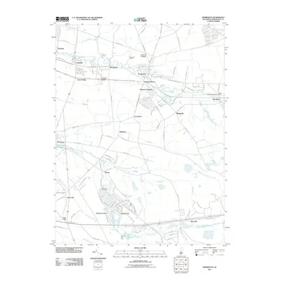
2011 Map of Pemberton
USGS Topo · Published 2011About this map
The North Branch Rancocas Creek and South Branch Rancocas Creek define the geography of this Burlington County landscape, anchoring a network of historic settlements and modern communities. Traditional centers like Pemberton, Vincentown, and New Lisbon are depicted alongside mid-century developments such as Leisuretowne and Hampton Lakes. The presence of the New Lisbon Mill Dam and the Vincentown Millpond points to the area's long-standing reliance on water power, while the Pemberton Airport and Red Lion Airport reflect more modern transportation infrastructure.
Find a feature on this map
130 named features on this map. Tap any name to fly to it.
Don’t see what you’re looking for? This feature index may not catch every label — zoom into the map to look around manually.
Map Details
Editions of this 2011 Pemberton Map
This is the sole edition of this map. No revisions or reprints were ever made.
Other maps of this area

1888 · Bordentown
USGS Topo · 1:62,500

1888 · Pemberton
USGS Topo · 1:62,500

1888 · Mount Holly
USGS Topo · 1:62,500

1890 · Burlington
USGS Topo · 1:62,500

1893 · Bordentown
USGS Topo · 1:62,500

1893 · Burlington
USGS Topo · 1:62,500

1894 · Pemberton
USGS Topo · 1:62,500

1894 · Mount Holly
USGS Topo · 1:62,500

1898 · Pemberton
USGS Topo · 1:62,500

1898 · Mount Holly
USGS Topo · 1:62,500
Featured Places
- Southampton Township, NJ
- Tabernacle Township, NJ
- Eastampton Township, NJ
- Springfield Township, NJ
- Pemberton, NJ