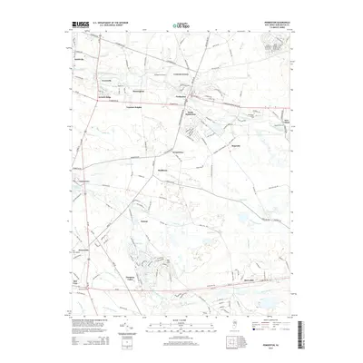
2014 Map of Pemberton
USGS Topo · Published 2014About this map
Vincentown and its landmark Vincentown Millpond anchor the western reaches of this Burlington County landscape, where the North Branch Rancocas Cr and its many tributaries wind through low-lying terrain. The area shows a distinct transition from the established borough of Pemberton to smaller, historically significant hamlets like Birmingham, Buddtown, and the curiously named Comical Corners. The South Jersey Pine Barrens influence is evident in the dense network of runs and creeks, including Jade Run, Cedar Run, and the S Br Rancocas Cr. Modern land use is represented by the Burlington County Coll campus and local aviation hubs like Pemberton Airport and Red Lion Airport. Southward, the residential developments of Hampton Lakes and Big Hill surround Old Forge Lake and Lake Three, illustrating the mid-century suburban expansion into the traditional agricultural and forested spaces of the New Jersey interior.
Find a feature on this map
163 named features on this map. Tap any name to fly to it.
Don’t see what you’re looking for? This feature index may not catch every label — zoom into the map to look around manually.
Map Details
Editions of this 2014 Pemberton Map
This is the sole edition of this map. No revisions or reprints were ever made.
Other maps of this area

1888 · Bordentown
USGS Topo · 1:62,500

1888 · Pemberton
USGS Topo · 1:62,500

1888 · Mount Holly
USGS Topo · 1:62,500

1890 · Burlington
USGS Topo · 1:62,500

1893 · Bordentown
USGS Topo · 1:62,500

1893 · Burlington
USGS Topo · 1:62,500

1894 · Pemberton
USGS Topo · 1:62,500

1894 · Mount Holly
USGS Topo · 1:62,500

1898 · Pemberton
USGS Topo · 1:62,500

1898 · Mount Holly
USGS Topo · 1:62,500
Featured Places
- Southampton Township, NJ
- Tabernacle Township, NJ
- Eastampton Township, NJ
- Springfield Township, NJ
- Pemberton, NJ