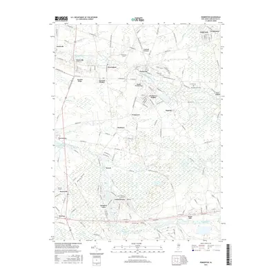
2016 Map of Pemberton
USGS Topo · Published 2016About this map
Pemberton serves as a central hub in this detailed survey of Burlington County, showing the intersection of residential growth and large-scale military and educational institutions. The northern edge of the map is dominated by the sprawling grounds of Fort Dix, while the educational campus of Burlington County Coll sits near New Lisbon. The landscape is defined by the winding paths of the North Branch Rancocas Creek and its many tributaries, such as Jade Run and Friendship Creek, which feed into local landmarks like the Vincentown Millpond.
Find a feature on this map
158 named features on this map. Tap any name to fly to it.
Don’t see what you’re looking for? This feature index may not catch every label — zoom into the map to look around manually.
Map Details
Editions of this 2016 Pemberton Map
This is the sole edition of this map. No revisions or reprints were ever made.
Other maps of this area

1888 · Bordentown
USGS Topo · 1:62,500

1888 · Pemberton
USGS Topo · 1:62,500

1888 · Mount Holly
USGS Topo · 1:62,500

1890 · Burlington
USGS Topo · 1:62,500

1893 · Bordentown
USGS Topo · 1:62,500

1893 · Burlington
USGS Topo · 1:62,500

1894 · Pemberton
USGS Topo · 1:62,500

1894 · Mount Holly
USGS Topo · 1:62,500

1898 · Pemberton
USGS Topo · 1:62,500

1898 · Mount Holly
USGS Topo · 1:62,500
Featured Places
- Southampton Township, NJ
- Tabernacle Township, NJ
- Eastampton Township, NJ
- Springfield Township, NJ
- Pemberton, NJ