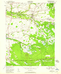
1949 Map of Pemberton
USGS Topo · Published 1959About this map
North Branch Rancocas Creek winds through the heart of Burlington County, anchoring a landscape defined by small-town life and specialized industry in the late 1940s. The settlement at Birmingham is marked by notable Brick Kilns, while to the east, the extensive Fort Dix Military Reservation began to reshape the local geography with its specialized facilities, including the Fort Dix Hospital and Newcomb Chest Hosp. This era shows the intricate water management required for agriculture, specifically the vast network of Cranberry Bogs and named waterways like Stop the Jade Run.
Find a feature on this map
53 named features on this map. Tap any name to fly to it.
Don’t see what you’re looking for? This feature index may not catch every label — zoom into the map to look around manually.
Map Details
Editions of this 1949 Pemberton Map
This is the sole edition of this map. No revisions or reprints were ever made.
Other maps of this area

1888 · Bordentown
USGS Topo · 1:62,500

1888 · Pemberton
USGS Topo · 1:62,500

1888 · Mount Holly
USGS Topo · 1:62,500

1890 · Burlington
USGS Topo · 1:62,500

1893 · Bordentown
USGS Topo · 1:62,500

1893 · Burlington
USGS Topo · 1:62,500

1894 · Pemberton
USGS Topo · 1:62,500

1894 · Mount Holly
USGS Topo · 1:62,500

1898 · Pemberton
USGS Topo · 1:62,500

1898 · Mount Holly
USGS Topo · 1:62,500
Featured Places
- Southampton Township, NJ
- Tabernacle Township, NJ
- Eastampton Township, NJ
- Springfield Township, NJ
- Pemberton, NJ