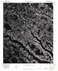
1976 Map of Pembroke
USGS Topo · Published 1978About this map
The town of Pembroke serves as the central hub of this 1976 orthophotograph, revealing the structured intersection of agricultural fields and residential development in Robeson County. This aerial perspective, captured in mid-January, provides a stark view of the landscape before the spring planting, highlighting the intricate drainage patterns and wooded corridors that define the coastal plain. Outside the main settlement, smaller communities such as Buie and Moss Neck appear as clusters along the rail and road network, while the northern area near Phil is dominated by a dense mosaic of farmland. This specific imagery captures the region's physical layout during a period of steady growth, allowing for a precise examination of property boundaries, field sizes, and the spatial relationship between the town center and its outlying rural hamlets.
Find a feature on this map
4 named features on this map. Tap any name to fly to it.
Don’t see what you’re looking for? This feature index may not catch every label — zoom into the map to look around manually.
Map Details
Editions of this 1976 Pembroke Map
This is the sole edition of this map. No revisions or reprints were ever made.
Other maps of this area

1949 · Wakulla
USGS Topo · 1:24,000

1949 · Laurinburg
USGS Topo · 1:62,500

1953 · Florence
USGS Topo · 1:250,000

1954 · Florence
USGS Topo · 1:250,000

1972 · Northwest Lumberton
USGS Topo · 1:24,000

1972 · Southwest Lumberton
USGS Topo · 1:24,000

1972 · Rennert
USGS Topo · 1:24,000

1972 · Pembroke
USGS Topo · 1:24,000
1972 · Rowland
USGS Topo · 1:24,000
1972 · Mc Donald
USGS Topo · 1:24,000