2023 Map of Pennsboro
USGS Topo · Published 2023About this map
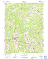
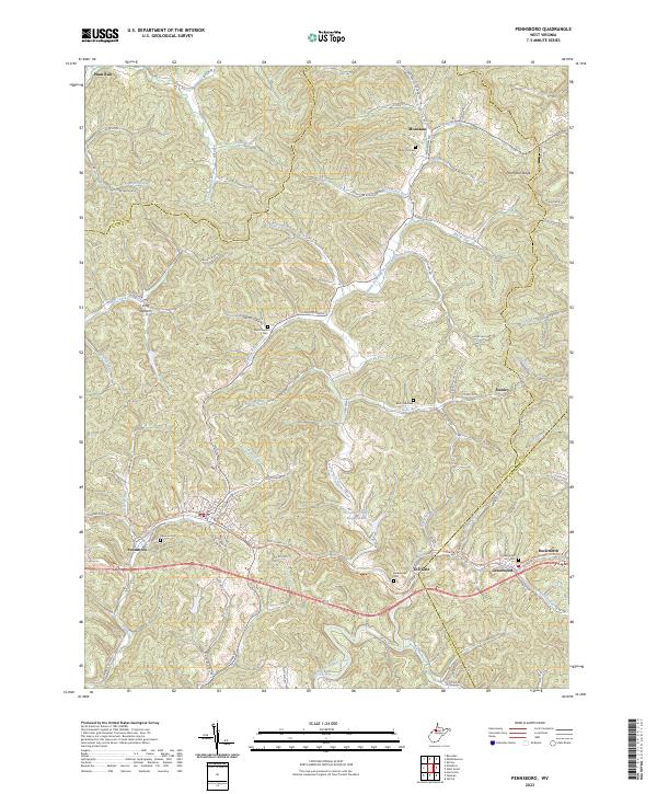
The North Fork Hughes River meanders through this portion of Ritchie and Tyler Counties, providing a central drainage for the deeply dissected hills and ridges of the region. The city of Pennsboro serves as the primary hub, situated near the western edge of the map where the North Bend Rail-Trl follows the old rail corridor through the heart of town. To the east, smaller settlements like Toll Gate, Greenwood, and Duckworth line the valley, reflecting a historical transportation pattern along the river and modern road systems. Local history is deeply embedded in the landscape via several family and community burial sites, including the Masonic Cem, Mole Hill Cem, and Burnthouse Cem. The area’s infrastructure is further defined by the Pennsboro Water Supply Lake and a dense network of secondary routes like Yeager Run Rd and Bonds Creek Rd that connect isolated ridges such as Haymond Ridge.
Find a feature on this map
93 named features on this map. Tap any name to fly to it.
Don’t see what you’re looking for? This feature index may not catch every label — zoom into the map to look around manually.
Map Details
Editions of this 2023 Pennsboro Map
This is the sole edition of this map. No revisions or reprints were ever made.
Historical Maps of Duckworth Through Time
3 maps found