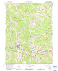
1961 Map of Pennsboro
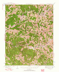
USGS Topo · Published 1992About this map
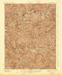
The Baltimore and Ohio railroad corridor anchors the southern half of this West Virginia landscape, following the winding valley of the South Fork Hughes River through the Ritchie and Doddridge county borderlands. The town of Pennsboro serves as the primary hub, showing a dense concentration of structures, a Racetrack, and the Masonic Cem. Further east, smaller settlements like Toll Gate, Greenwood, and Duckworth line the rail and road network, illustrating the era's transport-dependent development pattern.
Find a feature on this map
58 named features on this map. Tap any name to fly to it.
Don’t see what you’re looking for? This feature index may not catch every label — zoom into the map to look around manually.
Map Details
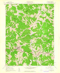
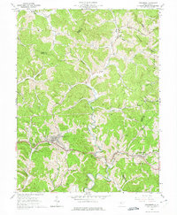
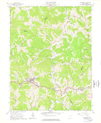
Editions of this 1961 Pennsboro Map
4 editions found
Other maps of this area

1905 · West Union
USGS Topo · 1:62,500

1906 · Saint Marys
USGS Topo · 1:62,500

1906 · Holbrook
USGS Topo · 1:62,500

1907 · Harrisville
USGS Topo · 1:62,500

1924 · St Marys
USGS Topo · 1:62,500
1924 · Harrisville
USGS Topo · 1:62,500

1924 · West Union
USGS Topo · 1:62,500

1924 · Holbrook
USGS Topo · 1:62,500
1926 · Harrisville
USGS Topo · 1:62,500

1926 · Holbrook
USGS Topo · 1:62,500