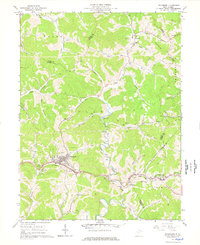
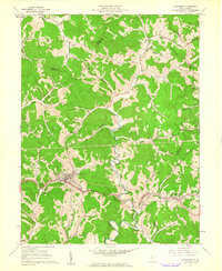
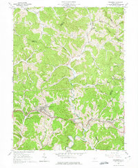
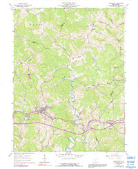
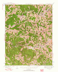
1961 Map of Pennsboro
USGS Topo · Published 1977About this map
Pennsboro sits at the heart of this mid-century West Virginia survey, marking a dense node of settlement along the Baltimore and Ohio RR. The landscape follows a distinctly rhythmic pattern of sharp ridges and deep drainage, where the North Fork Hughes River and its numerous tributaries like Bonds Creek and Gnat Run dictate the placement of roads and homesteads. The distribution of small country churches and burial grounds, such as the Mole Hill Chapel and the Burnthouse Cem, suggests a deeply rooted rural community organized around these narrow valley floors.
Find a feature on this map
53 named features on this map. Tap any name to fly to it.
Don’t see what you’re looking for? This feature index may not catch every label — zoom into the map to look around manually.
Map Details
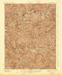
Editions of this 1961 Pennsboro Map
4 editions found
Other maps of this area

1905 · West Union
USGS Topo · 1:62,500

1906 · Saint Marys
USGS Topo · 1:62,500

1906 · Holbrook
USGS Topo · 1:62,500

1907 · Harrisville
USGS Topo · 1:62,500

1924 · St Marys
USGS Topo · 1:62,500
1924 · Harrisville
USGS Topo · 1:62,500

1924 · West Union
USGS Topo · 1:62,500

1924 · Holbrook
USGS Topo · 1:62,500
1926 · Harrisville
USGS Topo · 1:62,500

1926 · Holbrook
USGS Topo · 1:62,500