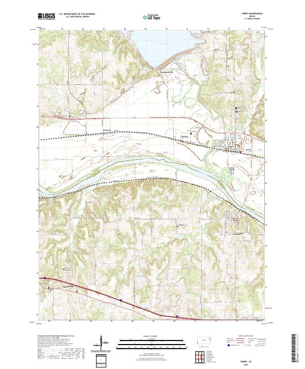
2022 Map of Perry
USGS Topo · Published 2022About this map
The Kansas River flows eastward across this landscape, defining the boundary between Jefferson and Douglas counties. Along its northern banks, the settlements of Perry, Medina, Newman, and Thompsonville occupy the fertile valley floor, while Lecompton and Grover sit on the southern bluffs. This modern topographical study highlights the significant hydraulic engineering at the north end of the quadrangle, where the Delaware River is impounded to form Perry Lake, protected by the massive infrastructure of Dam RD and Spillway RD.
Find a feature on this map
58 named features on this map. Tap any name to fly to it.
Don’t see what you’re looking for? This feature index may not catch every label — zoom into the map to look around manually.
Map Details
Editions of this 2022 Perry Map
This is the sole edition of this map. No revisions or reprints were ever made.
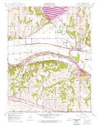
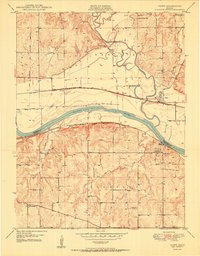
Historical Maps of Perry Through Time
3 maps found