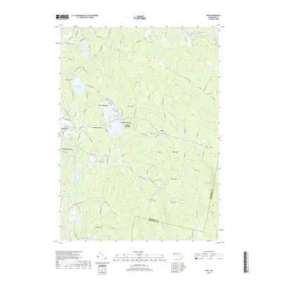
2018 Map of Peru
USGS Topo · Published 2018About this map
The hills of eastern Berkshire County are defined by high-elevation water bodies and a distinct summer recreation landscape. Ashmere Lake serves as a central hub for several longstanding youth camps, including Camp Taconic, Camp Lenore, and Camp Danbee, illustrating the region's historical role as a seasonal retreat. The terrain rises to several prominent heights such as Peru Hill and French Hill, with the small settlement of Peru situated at one of the highest town centers in Massachusetts.
Find a feature on this map
115 named features on this map. Tap any name to fly to it.
Don’t see what you’re looking for? This feature index may not catch every label — zoom into the map to look around manually.
Map Details
Editions of this 2018 Peru Map
This is the sole edition of this map. No revisions or reprints were ever made.
Other maps of this area

1886 · Greylock
USGS Topo · 1:62,500

1886 · Hawley
USGS Topo · 1:62,500

1886 · Chesterfield
USGS Topo · 1:62,500

1886 · Becket
USGS Topo · 1:62,500

1888 · Becket
USGS Topo · 1:62,500

1888 · Chesterfield
USGS Topo · 1:62,500

1890 · Hawley
USGS Topo · 1:62,500

1891 · Greylock
USGS Topo · 1:62,500

1893 · Chesterfield
USGS Topo · 1:62,500

1893 · Becket
USGS Topo · 1:62,500