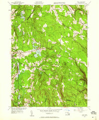
1945 Map of Peru
USGS Topo · Published 1958About this map
The town of Hinsdale and the elevated village of Peru anchor this mid-1940s survey of the Berkshire Highlands. This was an era of transition for these hill towns, where the landscape is defined by the steep topography of Peru Hill, French Hill, and Haskell Hill. The Boston and Albany RR follows the narrow corridor of the Housatonic River through the western portion of the sheet, serving the industrial and passenger needs of Washington Sta. Local history is deeply etched into the terrain through a series of namesake burial grounds, including North Cem, South Cem, and Perry Cem. The area's hydrology is equally prominent, featuring the expansive Ashmere Lake and the dramatic drop of Wahconah Falls in the northwest. Numerous rural routes such as Buttermilk Road and Old Frank Schnoor Road trace the paths of early settlers through these high woods.
Find a feature on this map
62 named features on this map. Tap any name to fly to it.
Don’t see what you’re looking for? This feature index may not catch every label — zoom into the map to look around manually.
Map Details
Editions of this 1945 Peru Map
This is the sole edition of this map. No revisions or reprints were ever made.
Other maps of this area

1886 · Greylock
USGS Topo · 1:62,500

1886 · Hawley
USGS Topo · 1:62,500

1886 · Chesterfield
USGS Topo · 1:62,500

1886 · Becket
USGS Topo · 1:62,500

1888 · Becket
USGS Topo · 1:62,500

1888 · Chesterfield
USGS Topo · 1:62,500

1890 · Hawley
USGS Topo · 1:62,500

1891 · Greylock
USGS Topo · 1:62,500

1893 · Chesterfield
USGS Topo · 1:62,500

1893 · Becket
USGS Topo · 1:62,500