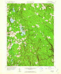
1959 Map of Peru
USGS Topo · Published 1960About this map
The town of Hinsdale and its neighbor Peru sit within a landscape of high-elevation water bodies and expansive public lands at the edge of the Berkshire and Hampshire county lines. This 1959 revision reflects a mid-century period of recreational development, evidenced by a cluster of summer retreats around Ashmere Lake, including Camp Taconic, Camp Danbee, and Camp Lenore. The East Branch Housatonic River flows through the western valley, shadowed by the New York New Haven and Hartford railroad line as it passes through the Hinsdale settlement. To the east, the terrain rises toward Peru Hill and French Hill, where conservation and public use dominate. Significant landmarks include the Dorothy Frances Rice Wildlife Refuge and the sprawling Peru State Forest, while local history is anchored by Hinsdale Cem, Peru Cem, and the North Cem.
Find a feature on this map
66 named features on this map. Tap any name to fly to it.
Don’t see what you’re looking for? This feature index may not catch every label — zoom into the map to look around manually.
Map Details
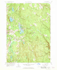
Editions of this 1959 Peru Map
2 editions found
Other maps of this area

1886 · Greylock
USGS Topo · 1:62,500

1886 · Hawley
USGS Topo · 1:62,500

1886 · Chesterfield
USGS Topo · 1:62,500

1886 · Becket
USGS Topo · 1:62,500

1888 · Becket
USGS Topo · 1:62,500

1888 · Chesterfield
USGS Topo · 1:62,500

1890 · Hawley
USGS Topo · 1:62,500

1891 · Greylock
USGS Topo · 1:62,500

1893 · Chesterfield
USGS Topo · 1:62,500

1893 · Becket
USGS Topo · 1:62,500