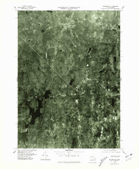
1975 Map of Petersham
USGS Topo · Published 1981About this map
Petersham and its surrounding landscape are captured in this 1975 aerial orthophotograph, showcasing the heavily forested terrain of central Massachusetts. The western portion of the map is dominated by the sprawling waters of the Quabbin Reservoir, a man-made body of water that fundamentally reshaped the geography and local history of Worcester County. The imagery reveals the intricate network of roads connecting small settlements like Bassets Corner to the village center.
Find a feature on this map
7 named features on this map. Tap any name to fly to it.
Don’t see what you’re looking for? This feature index may not catch every label — zoom into the map to look around manually.
Map Details
Editions of this 1975 Petersham Map
This is the sole edition of this map. No revisions or reprints were ever made.
Other maps of this area

1887 · Warwick
USGS Topo · 1:62,500

1887 · Belchertown
USGS Topo · 1:62,500

1887 · Winchendon
USGS Topo · 1:62,500

1887 · Barre
USGS Topo · 1:62,500

1889 · Barre
USGS Topo · 1:62,500

1889 · Warwick
USGS Topo · 1:62,500

1890 · Belchertown
USGS Topo · 1:62,500

1890 · Winchendon
USGS Topo · 1:62,500

1893 · Belchertown
USGS Topo · 1:62,500

1894 · Winchendon
USGS Topo · 1:62,500