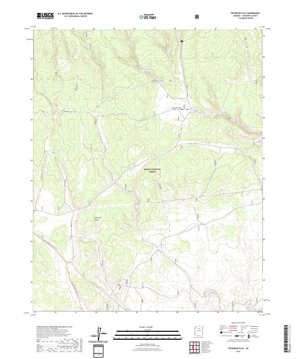
2021 Map of Peterson Flat
USGS Topo · Published 2021About this map
Kaiban National Forest terrain dominates this 2021 landscape in Coconino County, characterized by a complex network of seasonal water catchments vital to the region's ranching and wildlife history. These artificial reservoirs, such as Anderson Tank and Young Tank, serve as critical landmarks in an otherwise dry woodland environment. The topography is defined by the gradual descent of high-desert plateaus, where scattered tanks like Bear Tank mark the few reliable points of surface water. The map documents the persistent infrastructure of land management in northern Arizona, illustrating how these named water features continue to orient travelers and forest users across the forest's extensive section lines.
Find a feature on this map
3 named features on this map. Tap any name to fly to it.
Don’t see what you’re looking for? This feature index may not catch every label — zoom into the map to look around manually.
Map Details
Editions of this 2021 Peterson Flat Map
This is the sole edition of this map. No revisions or reprints were ever made.
Other maps of this area

1886 · San Francisco Mtns
USGS Topo · 1:250,000

1891 · San Francisco Mtns
USGS Topo · 1:250,000

1894 · San Francisco Mtns
USGS Topo · 1:250,000

1899 · San Francisco Mtns
USGS Topo · 1:250,000

1947 · Flagstaff
USGS Topo · 1:250,000

1954 · Flagstaff
USGS Topo · 1:250,000

1958 · Flagstaff
USGS Topo · 1:250,000

1960 · Flagstaff
USGS Topo · 1:250,000
1960 · Ebert Mtn
USGS Topo · 1:62,500

1962 · Flagstaff
USGS Topo · 1:250,000