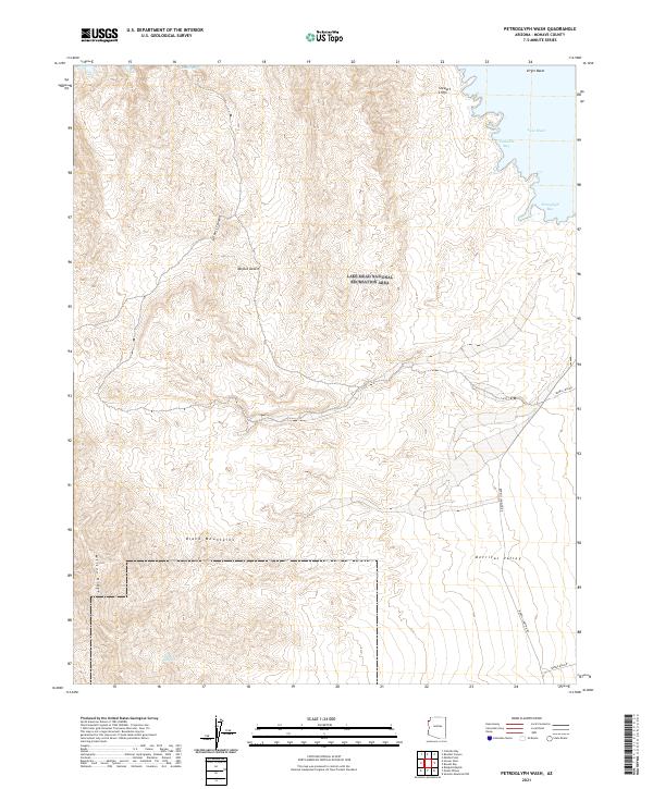
2021 Map of Petroglyph Wash
USGS Topo · Published 2021About this map
Lake Mead defines the northeastern corner of this landscape, its waters reaching into several prominent inlets such as Teakettle Bay and Petroglyph Bay. The surrounding territory is dominated by the Lake Mead National Recreation Area, where the jagged peaks of the Black Mountains and Wilson Ridge give way to the broad alluvial expanse of Detrital Valley. Evidence of interior water sources is scarce, marked only by the isolated Wildhorse Spring tucked among the southern ridges.
Find a feature on this map
22 named features on this map. Tap any name to fly to it.
Don’t see what you’re looking for? This feature index may not catch every label — zoom into the map to look around manually.
Map Details
Editions of this 2021 Petroglyph Wash Map
This is the sole edition of this map. No revisions or reprints were ever made.
Other maps of this area

1886 · Camp Mohave
USGS Topo · 1:250,000

1886 · Saint Thomas
USGS Topo · 1:250,000

1892 · Camp Mohave
USGS Topo · 1:250,000

1893 · Saint Thomas
USGS Topo · 1:250,000

1926 · Nelson
USGS Topo · 1:96,000

1926 · Bonelli
USGS Topo · 1:96,000

1926 · Boulder Canyon
USGS Topo · 1:96,000

1942 · Camp Mohave
USGS Topo · 1:250,000

1947 · Kingman
USGS Topo · 1:250,000

1948 · Kingman
USGS Topo · 1:250,000