
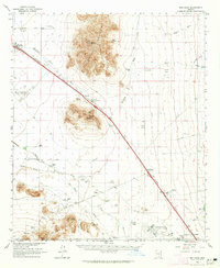
1980 Map of Picacho Pass
USGS Topo · Published 1980About this map
The Picacho Mountains rise abruptly from the desert floor in this arid landscape south of Arizona's copper corridors. In the late 1970s, the region was characterized by ephemeral drainage systems like McClellan Wash and Durham Wash, which highlight the importance of water access in the Pinal County ranching and mining country. The map documents scattered infrastructure such as the Landing Strip and a significant north-south Pipeline, alongside specialized water points including Barnett Well (Dry) and Clemens. To the west, the Gold Bell Mine and various Prospect sites indicate the area's geological potential. Transportation is anchored in the southwest corner by the Southern Pacific railroad and the eponymous Picacho Pass, a corridor that has served as a vital desert passage for centuries.
Find a feature on this map
16 named features on this map. Tap any name to fly to it.
Don’t see what you’re looking for? This feature index may not catch every label — zoom into the map to look around manually.
Map Details
Editions of this 1980 Picacho Pass Map
This is the sole edition of this map. No revisions or reprints were ever made.
Other maps of this area

1922 · Red Rock No 2
USGS Topo · 1:48,000

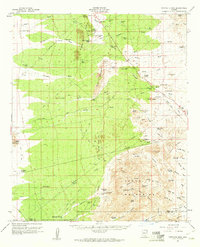
1934 · Newman Peak
USGS Topo · 1:125,000
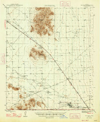
1947 · Red Rock
USGS Topo · 1:62,500

1956 · Tucson
USGS Topo · 1:250,000

1958 · Tucson
USGS Topo · 1:250,000

1959 · Tucson
USGS Topo · 1:250,000
1959 · Tortolita Mts
USGS Topo · 1:62,500

1962 · Tucson
USGS Topo · 1:250,000
1963 · Red Rock
USGS Topo · 1:62,500

1964 · Tucson
USGS Topo · 1:250,000