2022 Map of Pickwick
USGS Topo · Published 2022About this map
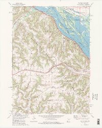
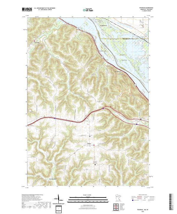
Pickwick and its surrounding valleys are defined by the convergence of the Mississippi River and its upland ridges. The topography here is dramatic, with high bluffs like Queens Bluff and Kings Bluff overlooking the river islands and side channels such as Spring Slough. This modern survey illustrates how traditional agriculture and rural settlements like Nodine and New Hartford persist alongside the CP Rail corridor and interstate infrastructure. Local history is anchored by several sites of genealogical interest, including the Saint John's Evangelical Lutheran Cem and Hiller Cem. The landscape transitions from the aquatic environments of Lake Onalaska and the Big Marsh to the intricate network of coulees and ridges, including Husman Ridge and Pea Ridge, which have long dictated the path of local roads like Little Trout Valley Rd.
Find a feature on this map
94 named features on this map. Tap any name to fly to it.
Don’t see what you’re looking for? This feature index may not catch every label — zoom into the map to look around manually.
Map Details
Editions of this 2022 Pickwick Map
This is the sole edition of this map. No revisions or reprints were ever made.