2023 Map of Picture Rocks
USGS Topo · Published 2023About this map
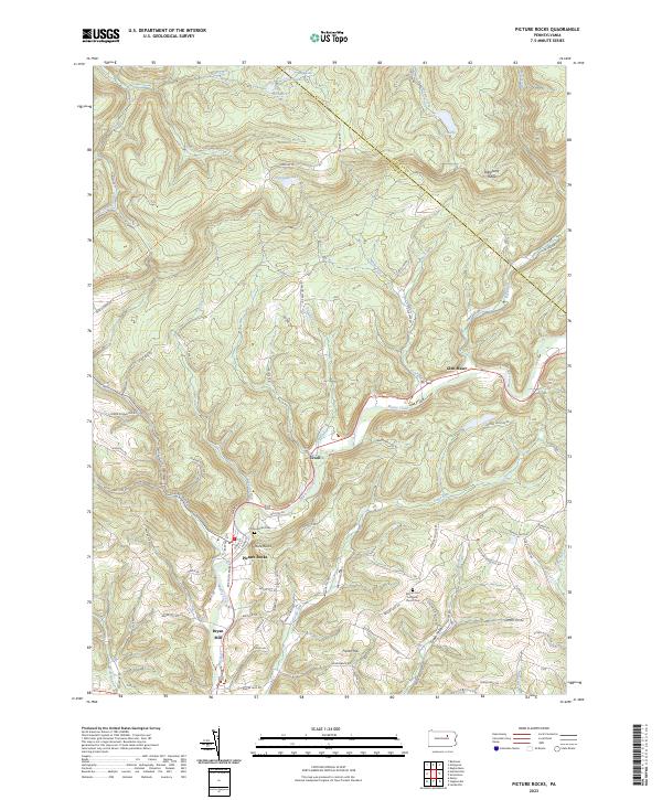
Muncy Creek carves a central path through this Lycoming County landscape, where the borough of Picture Rocks serves as a focal point of local settlement. The terrain transitions from the elevations of Allegheny Ridge in the north down toward the valley floor, where small hamlets like Tivoli and Glen Mawr are situated. The area is defined by a dense network of water bodies, including Wild Rice Lake, Crystal Lake, and Mudd Lake, which feed the various runs and branches tributary to the main creek.
Find a feature on this map
77 named features on this map. Tap any name to fly to it.
Don’t see what you’re looking for? This feature index may not catch every label — zoom into the map to look around manually.
Map Details
Editions of this 2023 Picture Rocks Map
This is the sole edition of this map. No revisions or reprints were ever made.
Historical Maps of Shrewsbury Township Through Time
Featured Locations
- Penn Township, PA
- Picture Rocks, PA
- Franklin Township, PA
- Shrewsbury Township, PA
- Hillsgrove Township, PA