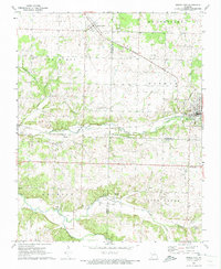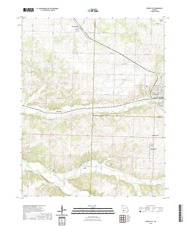
2021 Map of Pierce City
USGS Topo · Published 2021About this map
Pierce City and the surrounding borderlands of Lawrence, Newton, and Barry counties are defined by a network of rural settlements and winding spring-fed waterways. This 2021 survey shows the established town centers of Wentworth, Berwick, and Yonkerville, alongside the larger industrial footprint of Monett and its associated Monett Regional Airport. The landscape is a mix of agricultural plots and drainage basins for major local streams like Shoal Creek and Capps Creek. Local history is anchored by landmarks such as Wright Cem near the Newton County line and the small community of Jolly to the south. Distinctive hydrological features, including Hawkins Spring and Meane Spring, suggest a terrain shaped by the Ozark Plateau's subterranean water systems, while the grid of farm-to-market roads like State Hwy JJ and Douglas Fir Rd connect the scattered homesteads of this farming region.
Find a feature on this map
126 named features on this map. Tap any name to fly to it.
Don’t see what you’re looking for? This feature index may not catch every label — zoom into the map to look around manually.
Map Details
Editions of this 2021 Pierce City Map
This is the sole edition of this map. No revisions or reprints were ever made.