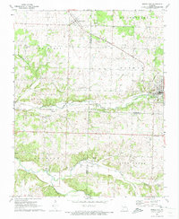
1972 Map of Pierce City
USGS Topo · Published 1973About this map
Pierce City and the surrounding rural landscape of Southwest Missouri are documented here in the early 1970s. The ST Louis - San Francisco railroad serves as the primary industrial artery, cutting through the terrain and connecting settlements like Wentworth and Berwick. This rail-oriented development is particularly evident in the north, where large deposits of tailings and a Quarry indicate active or past mineral extraction along the line. Southward, the landscape transitions into a more agricultural and natural setting, defined by the winding paths of Shoal Creek and Capps Creek. Local community life is anchored by landmarks such as Berwick Ch and Bethel Ch, alongside small pockets of habitation like the crossroads at Jolly. Notable geographic features such as Jolly Cave and various spring sites, including Cave Spring, underscore the karst topography characteristic of this part of Lawrence County.
Find a feature on this map
35 named features on this map. Tap any name to fly to it.
Don’t see what you’re looking for? This feature index may not catch every label — zoom into the map to look around manually.
Map Details
Editions of this 1972 Pierce City Map
This is the sole edition of this map. No revisions or reprints were ever made.
Other maps of this area

1886 · Greenfield
USGS Topo · 1:125,000

1886 · Carthage
USGS Topo · 1:125,000

1888 · Greenfield
USGS Topo · 1:125,000

1894 · Carthage
USGS Topo · 1:125,000

1921 · Stotts City
USGS Topo · 1:62,500

1921 · Sarcoxie
USGS Topo · 1:62,500

1943 · Ritchey
USGS Topo · 1:62,500

1943 · Monett
USGS Topo · 1:62,500

1945 · Harrison
USGS Topo · 1:250,000

1947 · Joplin
USGS Topo · 1:250,000