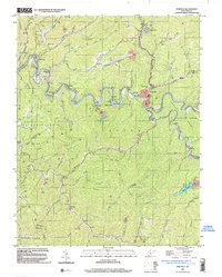
1996 Map of Pineville
USGS Topo · Published 2003About this map
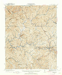
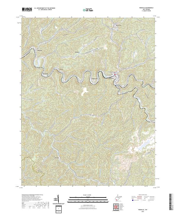
The Guyandotte River winds through the heart of Wyoming County, where the Norfolk and Western railway snakes along its banks to serve a series of riverside coal communities. The landscape is defined by tight valleys and steep ridges like Turkey Ridge and Micajah Ridge, where settlements such as Marianna, Glover, and Mullensville are concentrated in the narrow bottomlands. In Pineville, the county seat, the convergence of Rockcastle Creek and the river creates a central hub for the region's infrastructure, including a Filtration Plant and Communication Tower. Evidence of the area's industrial character is visible in the Strip Mine workings and various smaller mines scattered across the hills. Local spiritual and civic life is anchored by landmarks like Turkey Creek Ch, Cooper Ch, and Brewster Chapel, while Kee Field and several mobile home parks indicate the 20th-century expansion of these mountain townships.
Find a feature on this map
65 named features on this map. Tap any name to fly to it.
Don’t see what you’re looking for? This feature index may not catch every label — zoom into the map to look around manually.
Map Details
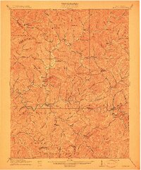
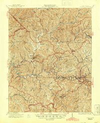
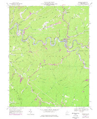
Editions of this 1996 Pineville Map
This is the sole edition of this map. No revisions or reprints were ever made.
Historical Maps of Pineville Through Time
6 maps found