
Loading...
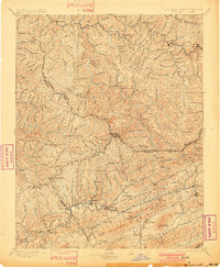
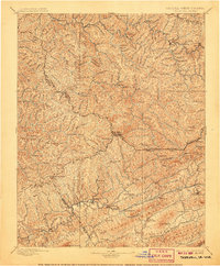
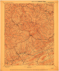
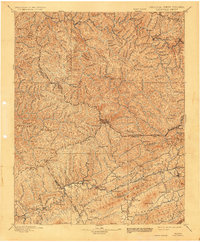
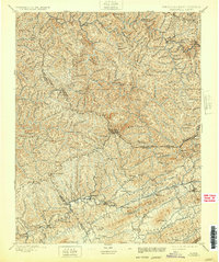
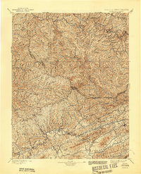
Loading map...1897 Map of Tazewell
USGS Topo · Published 1897About this map
Tazewell and the surrounding coalfields of the Virginia-West Virginia borderlands are captured here just before the turn of the century. The Norfolk and Western Railway serves as the primary artery for the region, threading through the steep valleys of the Tug River to reach emerging industrial hubs like Welch, Vivian, and Kimball. This 1893 topography shows a landscape in transition, where established agricultural centers such as Thompson Valley and Baptist Valley coexist with newer rail-dependent settlements.
Find a feature on this map
91 named features on this map. Tap any name to fly to it.
Don’t see what you’re looking for? This feature index may not catch every label — zoom into the map to look around manually.
Map Details
Date Portrayed1897
Date Published1897
PublisherU.S. Geological Survey
Map TypeTopographic
Scale1:125,000
Physical Dimensions16.4 x 20 inches
Editions of this 1897 Tazewell Map
8 editions found

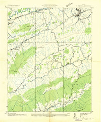
Historical Maps of Richlands Through Time
4 maps found


Featured Locations
Source Details
SourceU.S. Geological Survey
CopyrightPublic Domain