1887 Map of Warfield
USGS Topo · Published 1887About this map
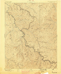
The Tug Fork of Big Sandy River carves a winding path through the Central Appalachian coalfields, defining the West Virginia Kentucky Boundary Line between Martin and Logan counties. This late nineteenth-century landscape is dominated by a complex network of narrow hollows and high ridges, where small settlements like Warfield and White Post sit at critical river bends. The map documents the intricate drainage patterns of the region, including the Right Fork of Twelve Pole Creek and Jennies Creek, long before modern industrial development reshaped the valleys. Local historians can trace the early footprints of communities such as Chapmansville and Hatfield, which appear as small clusters of activity along the watercourses. The lack of major rail infrastructure at this date highlights the river-dependent nature of life in the Pike and Wayne county borderlands during the 1880s.
Find a feature on this map
74 named features on this map. Tap any name to fly to it.
Don’t see what you’re looking for? This feature index may not catch every label — zoom into the map to look around manually.
Map Details
Editions of this 1887 Warfield Map
This is the sole edition of this map. No revisions or reprints were ever made.