Old Maps of Tazewell County, Virginia
Explore 188 old maps of Tazewell County, spanning from 1887 to today. These high-resolution historic maps reveal how streets, neighborhoods, landmarks, and natural features evolved over time — perfect for genealogy, metal detecting, research, and local history exploration.
What you can do with these maps:
- See how Tazewell County changed over time: Compare historical maps to modern-day views to trace roads, homesites, rail lines & more.
- View detailed metadata: Each map includes creators, publishers, year, scale, and archive source.
- Overlay maps with satellite & LiDAR: Visualize the past alongside modern tools to explore terrain & human change.
- Trusted historical sources: Maps sourced from the USGS, Library of Congress, and other archives.
- Access maps your way: View online, download high-res files, or order prints for personal or research use.
Start exploring old maps of Tazewell County to uncover forgotten places, hidden landmarks, and the deep history beneath your feet.
Tazewell County, VA maps
(188)- 1887 Map of Pocahontas
 1887 Pocahontas1887 Print · USGSThe Virginia and West Virginia borderlands are shown here in the 1880s as the coal industry and railroads began to reshape the Appalachian ridges. Genealogists can locate early settlements and landmarks like Seddon (Bland C. H.), the valley at Burks Garden, and the Concord Church congregation.
 - 1889 Map of Wytheville
 1889 Wytheville1889 Print · USGSSouthwestern Virginia and northwestern North Carolina are mapped here during the late nineteenth-century rise of the mountain iron industry. Genealogists and historians can locate early post offices and industrial sites such as Bridle Creek P.O., Eagle Furnace, and Rural Retreat.2 unique versions available
 - 1891 Map of Tazewell
 1891 Tazewell1891 Print · USGSThe Clinch Valley highlands are shown here in the late nineteenth century, capturing the early settlement of the Virginia and West Virginia borderlands. Local historians can trace the foundations of Jeffersonville and rural outposts like Baptist Valley and Cedar Bluff.
 - 1891 Map of Pocahontas
 1891 Pocahontas1891 Print · USGSThe Virginia and West Virginia borderlands are captured here during the late nineteenth-century expansion of the coal and rail industries. Genealogists and researchers can locate early settlements like Sedon (Bland CH), Spanishburg, and Pocahontas along the newly laid Norfolk and Western Railroad.
 - 1891 Map of Abingdon
 1891 Abingdon1891 Print · USGSSouthwest Virginia in the 1890s reveals a landscape of mountain ridges and thriving valley settlements along the Norfolk and Western R. R. Lineages can be traced through sites like Emory and Henry College, Saltville, and numerous family-named landmarks like Vance's Mill.
 - 1892 Map of Wytheville, 1897 Print
 1892 Wytheville1897 Print · USGSThe high ridges and river valleys of Southwest Virginia and Northwest North Carolina are captured here in the late nineteenth century. Genealogists can trace family footprints across the Iron Mountains to old industrial sites like White Rock Furnace and remote post offices such as Hampton P.O.6 unique versions available
 - 1894 Map of Pocahontas
 1894 Pocahontas1894 Print · USGSThe Virginia and West Virginia borderlands are shown here during the late nineteenth-century coal boom. Researchers can trace early railroad expansion through settlements like Pocahontas or locate family roots in mountain basins such as Burke Garden and Sed Don.
 - 1894 Map of Abingdon, 1896 Print
 1894 Abingdon1896 Print · USGSSouthwest Virginia's valley and ridge country is captured here during the peak of the rail era, centered on the Abingdon and Marion corridors. Local historians can trace the foundations of Emory and Henry College and numerous rural mill sites like Belfast Mills or Vance's Mill.5 unique versions available
 - 1895 Map of Tazewell
 1895 Tazewell1895 Print · USGSSouthwest Virginia and the West Virginia coalfields are captured in the 1890s as the rail network transformed these mountain valleys. Researchers can trace early settlements and stores along the Norfolk and Western RR, from Tazewell to the mines near Welch and Vivian.
 - 1895 Map of Pocahontas
 1895 Pocahontas1895 Print · USGSCoal mining towns and the Norfolk and Western RR line the border of Virginia and West Virginia in the late nineteenth century. Genealogists can trace the early layouts of Pocahontas, Bluefield, and the unusual enclosed valley of Burke Garden.6 unique versions available
 - 1897 Map of Tazewell
 1897 Tazewell1897 Print · USGSThe rugged coal and timber lands of the border country appear here in the 1890s as the rail network expands. Genealogists can trace family roots at Mc Neil Store, follow the early growth of Welch, and locate homesteads near Shack Mills.8 unique versions available
 - 1909 Map of Pocahontas Special
 1909 Pocahontas Special1909 Print · USGSThe Pocahontas coalfields are at the peak of their industrial expansion in this early century survey. Genealogists and historians can trace rail-tied communities like Switchback P O, Bramwell, and the rural Bailey Chapel along the steep mountain ridges.
 - 1909 Map of Abingdon
 1909 Abingdon1909 Print · USGSSouthwest Virginia at the first decade's end shows a valley landscape defined by the iron rail and steep ridges. Genealogists and historians can trace the early layouts of Abingdon and Glade Spring, or locate landmarks like Dove Mills and the County Farm.2 unique versions available
 - 1911 Map of Abingdon
 1911 Abingdon1911 Print · USGSSouthwest Virginia's rugged corridors are captured here during the height of the mountain rail era. Genealogists and historians can trace old homesteads and local landmarks such as Whites Mill, Valley Church, and the County Farm near Abingdon.5 unique versions available
 - 1911 Map of Pocahontas Special
 1911 Pocahontas Special1911 Print · USGSThe West Virginia coalfields are in full industrial bloom in this early century survey, showing the rail-dependent towns along the Norfolk & Western RR. Genealogists can trace family locations in mining hubs like Keystone, Goodwill, and Bearwallow Worth PO.
 - 1912 Map of Pounding Mill
 1912 Pounding Mill1912 Print · USGSThe McDowell and Tazewell borderlands appear here in the decade before the First World War, showing the early infrastructure of this mountainous region. Researchers can trace the path of Squire Jim Road and locate the settlement of Horsepen among the headwaters of Big Creek.
 - 1912 Map of Welch
 1912 Welch1912 Print · USGSMcDowell County's coal country comes alive in this pre-war survey, centered on the junction of the Norfolk and Western RR and the Tug Fork. Trace the early development of mining towns like Coalwood, Gary, and Kimball or locate vanished post offices such as Yukon PO.2 unique versions available
 - 1913 Map of Bluefield
 1913 Bluefield1913 Print · USGSMercer County and the Virginia borderlands are captured here just before the Great War, showing a landscape of mountain ridges and river valleys. Genealogists and historians can locate dozens of early rural schoolhouses like Sand Gap School and Grecian Bend School, alongside the developing streets of Princeton and South Bluefield.
 - 1915 Map of Richlands
 1915 Richlands1915 Print · USGSThe Clinch River valley in the years before the Great War is a network of coal-country settlements and mountain passes. Genealogists can locate family schoolhouses like Drill School or trace the early Norfolk and Western rail lines through Raven and Richlands.
 - 1916 Map of Bluefield
 1916 Bluefield1916 Print · USGSMercer County and the Virginia border come alive in this survey of coal-country rail and mountain ridge communities. Genealogists can trace family roots through dozens of named schools like Sand Gap School and early post offices such as Hardy PO.
 - 1916 Map of Pounding Mill
 1916 Pounding Mill1916 Print · USGSThe Virginia and West Virginia state line was a rugged landscape of isolated mountain hollows and ridge-top knobs during the early twentieth century. Genealogists can trace family footprints near Greasy Creek School, the NORFOLK AND WESTERN RR, and the settlement of Sayersville.
 - 1916 Map of Richlands
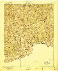 1916 Richlands1916 Print · USGSThe Clinch River valley was entering a period of industrial growth just before the First World War as rail lines followed the water. Genealogists can trace family roots through numerous mountain schools and hamlets like Antioch School, Red Ash, and Cedar Bluff.5 unique versions available
 - 1924 Map of Bramwell, 1956 Print
 1924 Bramwell1956 Print · USGSCoalfield life thrives along the river-and-rail corridor in the early twentieth century. Researchers can trace family roots in industrial settlements like Jenkinjones and Northfork or locate landmarks such as Bailey Chapel and Little Creek School.
 - 1924 Map of Welch, 1957 Print
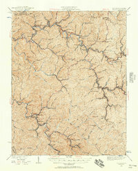 1924 Welch1957 Print · USGSSouthern West Virginia’s coal country is captured here during the 1920s, showing the height of the rail-and-mine economy. Researchers can trace the legacy of company towns and family homesteads near Welch, Coalwood, and the Warrior Mine.2 unique versions available
 - 1924 Map of Bluefield, 1966 Print
 1924 Bluefield1966 Print · USGSThe West Virginia and Virginia borderlands show significant growth in the mid-1920s as rail lines and mountain settlements expand. Genealogists can trace family names through dozens of rural landmarks like Mercer Healing Springs, Wenonah, and the Barber School.
Showing maps 1-25 of 188
Top cities of Tazewell County
- Richlands historical maps
- Bluefield historical maps
- Tazewell historical maps
- Raven historical maps
- Claypool Hill historical maps
- Cedar Bluff historical maps
See more
Frequently asked questions
- What are the different types of historical maps available for Tazewell County?
- What is the oldest map of Tazewell County?
- Where can I purchase historical maps of Tazewell County for my home or office?
- Where can I download high-res historical maps of Tazewell County?
- Are there historical topographic maps available for Tazewell County?
- Is there historical aerial imagery available for Tazewell County?
- Where are historical maps of Tazewell County sourced from?