Loading...
Loading map...2023 Map of Pinon
USGS Topo · Published 2023About this map
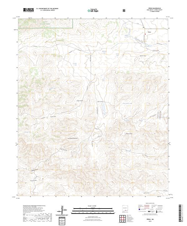
Pinon stands as the primary settlement in this high-desert landscape of Otero County, where the southern reaches of the Lincoln National Forest meet the dramatic topography of the Sacramento Mountains. The region is defined by a complex network of arroyos and canyons, including Gregg Canyon and Chatfield Canyon, which dictate the local travel routes like the Owen Prather Hwy.
Find a feature on this map
45 named features on this map. Tap any name to fly to it.
Don’t see what you’re looking for? This feature index may not catch every label — zoom into the map to look around manually.
Map Details
Date Portrayed2023
Date Published2023
PublisherU.S. Geological Survey
Map TypeTopographic
Scale1:24000
Physical Dimensions24 x 29 inches
Editions of this 2023 Pinon Map
This is the sole edition of this map. No revisions or reprints were ever made.
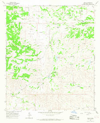
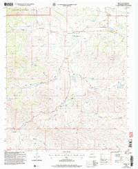
Historical Maps of Piñon Through Time
Featured Locations
Source Details
SourceU.S. Geological Survey
CopyrightPublic Domain