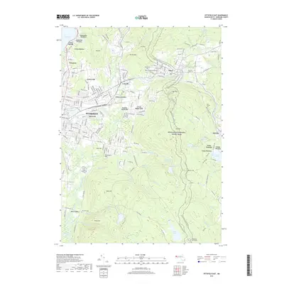
2018 Map of Pittsfield East
USGS Topo · Published 2018About this map
Pittsfield and the neighboring industrial corridor along the East Branch Housatonic River define this 2018 topographic landscape. The area is characterized by a high concentration of recreational and community infrastructure, including numerous summer camps like Camp Romaca and Camp Emerson near the Plunkett Reservoir. Further north, residential clusters such as Pontoosuc Gardens and Lakeview Terrace border Pontoosuc Lake, while the industrial legacy of the region is evident in the Housatonic RR corridor and various named industrial districts. The eastern half of the quadrangle is dominated by the rugged slopes of Washington Mtn and Day Mtn, which are traversed by the iconic Appalachian National Scenic Trail. Numerous reservoirs, including Hathaway Reservoir and Ashley Reservoir, highlight the region's managed water resources alongside conserved spaces like The Boulders.
Find a feature on this map
136 named features on this map. Tap any name to fly to it.
Don’t see what you’re looking for? This feature index may not catch every label — zoom into the map to look around manually.
Map Details
Editions of this 2018 Pittsfield East Map
This is the sole edition of this map. No revisions or reprints were ever made.
Other maps of this area

1886 · Greylock
USGS Topo · 1:62,500

1886 · Becket
USGS Topo · 1:62,500

1888 · Becket
USGS Topo · 1:62,500

1888 · Berlin
USGS Topo · 1:62,500

1888 · Pittsfield
USGS Topo · 1:62,500

1890 · Pittsfield
USGS Topo · 1:62,500

1890 · Berlin
USGS Topo · 1:62,500

1891 · Greylock
USGS Topo · 1:62,500

1893 · Becket
USGS Topo · 1:62,500

1893 · Greylock
USGS Topo · 1:62,500