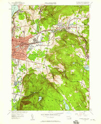
1944 Map of Pittsfield East
USGS Topo · Published 1958About this map
The East Branch Housatonic River serves as the industrial and geographic anchor for this mid-century survey of the Berkshires. The eastern edge of Pittsfield dominates the western quadrant, showing the dense residential grid organized around Elm St and Williams St, while the town of Dalton sits at the confluence of several mountain streams. This area is characterized by a complex network of reservoirs including Ashley Reservoir, Farnham Reservoir, and Plunkett Reservoir, which highlight the region's historical focus on municipal water management and hydropower.
Find a feature on this map
70 named features on this map. Tap any name to fly to it.
Don’t see what you’re looking for? This feature index may not catch every label — zoom into the map to look around manually.
Map Details
Editions of this 1944 Pittsfield East Map
This is the sole edition of this map. No revisions or reprints were ever made.
Other maps of this area

1886 · Greylock
USGS Topo · 1:62,500

1886 · Becket
USGS Topo · 1:62,500

1888 · Becket
USGS Topo · 1:62,500

1888 · Berlin
USGS Topo · 1:62,500

1888 · Pittsfield
USGS Topo · 1:62,500

1890 · Pittsfield
USGS Topo · 1:62,500

1890 · Berlin
USGS Topo · 1:62,500

1891 · Greylock
USGS Topo · 1:62,500

1893 · Becket
USGS Topo · 1:62,500

1893 · Greylock
USGS Topo · 1:62,500