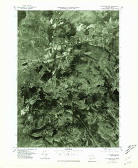
1975 Map of Pittsfield East
USGS Topo · Published 1981About this map
Pittsfield and its eastern suburbs are shown here through a detailed orthophotographic lens captured in the mid-1970s. The dense residential and industrial footprint of the city transitions into the neighboring settlements of Dalton and Hinsdale, revealing the mid-century expansion of the Berkshire region. The dominant geographical feature is the path of the Housatonic River and its East Branch, which provide the topographical framework for the local infrastructure and the layout of Green Ridge Park. To the northwest, the edge of Pontoosuc Lake serves as a significant landmark at the quadrangle boundary. This aerial survey provides a rare visual record of land use and timber cover before modern development altered the rural-urban fringe of these Massachusetts towns.
Find a feature on this map
7 named features on this map. Tap any name to fly to it.
Don’t see what you’re looking for? This feature index may not catch every label — zoom into the map to look around manually.
Map Details
Editions of this 1975 Pittsfield East Map
This is the sole edition of this map. No revisions or reprints were ever made.
Other maps of this area

1886 · Greylock
USGS Topo · 1:62,500

1886 · Becket
USGS Topo · 1:62,500

1888 · Becket
USGS Topo · 1:62,500

1888 · Berlin
USGS Topo · 1:62,500

1888 · Pittsfield
USGS Topo · 1:62,500

1890 · Pittsfield
USGS Topo · 1:62,500

1890 · Berlin
USGS Topo · 1:62,500

1891 · Greylock
USGS Topo · 1:62,500

1893 · Becket
USGS Topo · 1:62,500

1893 · Greylock
USGS Topo · 1:62,500