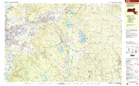
1997 Map of Pittsfield East
USGS Topo · Published 1999About this map
Dalton and Hinsdale anchor this detailed survey of the eastern Berkshire hills, showing the region's balance of industrial legacy and protected woodlands in the late 1990s. The Conrail line follows the valley of the Housatonic River, passing through the manufacturing core of Pittsfield and past Silver Lake. The map reveals a landscape defined by water management, with numerous reservoirs such as Cleveland Brook Reservoir, Ashmere Lake, and Plunkett Reservoir serving the region's needs.
Find a feature on this map
87 named features on this map. Tap any name to fly to it.
Don’t see what you’re looking for? This feature index may not catch every label — zoom into the map to look around manually.
Map Details
Editions of this 1997 Pittsfield East Map
This is the sole edition of this map. No revisions or reprints were ever made.
Other maps of this area

1886 · Greylock
USGS Topo · 1:62,500

1886 · Hawley
USGS Topo · 1:62,500

1886 · Chesterfield
USGS Topo · 1:62,500

1886 · Becket
USGS Topo · 1:62,500

1888 · Becket
USGS Topo · 1:62,500

1888 · Berlin
USGS Topo · 1:62,500

1888 · Chesterfield
USGS Topo · 1:62,500

1888 · Pittsfield
USGS Topo · 1:62,500

1890 · Hawley
USGS Topo · 1:62,500

1890 · Pittsfield
USGS Topo · 1:62,500