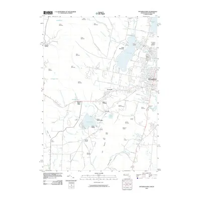
2010 Map of Pittsfield West
USGS Topo · Published 2010About this map
Hancock Shaker Village and the western edge of Pittsfield anchor this landscape, where the Berkshires' industrial past and recreational identity converge. The terrain is defined by the high ridges of Yokun Ridge and Osceola Mountain, which drop sharply toward the developed valley floor. Long-standing local landmarks like the Bousquet Ski Area and Catamount Ski Area sit adjacent to the Pittsfield Municipal Airport, illustrating the multi-use nature of the foothills. Water dominates the northern and central sections, with Onota Lake and Richmond Pond serving as major geographic centers. Historically significant sites, including Saint Josephs Cemetery and the Love of Peace Cemetery, offer specific points of interest for genealogists tracing families in the Barkerville and Stearnsville neighborhoods.
Find a feature on this map
101 named features on this map. Tap any name to fly to it.
Don’t see what you’re looking for? This feature index may not catch every label — zoom into the map to look around manually.
Map Details
Editions of this 2010 Pittsfield West Map
This is the sole edition of this map. No revisions or reprints were ever made.
Other maps of this area

1886 · Greylock
USGS Topo · 1:62,500

1886 · Becket
USGS Topo · 1:62,500

1888 · Becket
USGS Topo · 1:62,500

1888 · Berlin
USGS Topo · 1:62,500

1888 · Pittsfield
USGS Topo · 1:62,500

1890 · Pittsfield
USGS Topo · 1:62,500

1890 · Berlin
USGS Topo · 1:62,500

1891 · Greylock
USGS Topo · 1:62,500

1893 · Becket
USGS Topo · 1:62,500

1893 · Greylock
USGS Topo · 1:62,500