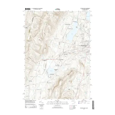
2015 Map of Pittsfield West
USGS Topo · Published 2015About this map
Hancock Shaker Village stands as a focal point of cultural history along the transition between the Taconic Range and the growing urban edge of Pittsfield. This survey illustrates the contrast between the preserved communal architecture of the Shakers and the modern development surrounding the Pittsfield Municipal Airport. The landscape is defined by its water and high ground, from the deep waters of Onota Lake and Richmond Pond to the prominent heights of Lenox Mtn and Yokun Seat. Smaller settlements like Barkerville and Stearnsville sit tucked along the West Branch Housatonic River, while educational and recreational sites such as Berkshire Community Coll and Camp Russell dot the terrain. For genealogists, several burial grounds including Saint Josephs Cem and Love of Peace Cem provide specific points of interest for family research.
Find a feature on this map
176 named features on this map. Tap any name to fly to it.
Don’t see what you’re looking for? This feature index may not catch every label — zoom into the map to look around manually.
Map Details
Editions of this 2015 Pittsfield West Map
This is the sole edition of this map. No revisions or reprints were ever made.
Other maps of this area

1886 · Greylock
USGS Topo · 1:62,500

1886 · Becket
USGS Topo · 1:62,500

1888 · Becket
USGS Topo · 1:62,500

1888 · Berlin
USGS Topo · 1:62,500

1888 · Pittsfield
USGS Topo · 1:62,500

1890 · Pittsfield
USGS Topo · 1:62,500

1890 · Berlin
USGS Topo · 1:62,500

1891 · Greylock
USGS Topo · 1:62,500

1893 · Becket
USGS Topo · 1:62,500

1893 · Greylock
USGS Topo · 1:62,500