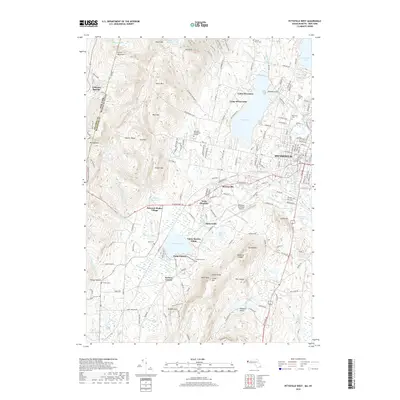
2018 Map of Pittsfield West
USGS Topo · Published 2018About this map
Hancock Shaker Village sits at the heart of this landscape, marking a distinctive religious and architectural legacy along the West Branch Housatonic River. The terrain transitions from the residential and industrial corridors of Pittsfield in the east toward the high ridges of the Taconic Range in the west, which forms the state boundary between New York and Massachusetts. The map documents a complex water network including Onota Lake and Richmond Pond, which are surrounded by various recreational sites like Camp Witawentin and Camp Russell. Numerous burial grounds, such as Saint Josephs Cem and the Love of Peace Cem, provide a spatial record of the area's diverse community history. This 2018 survey reveals how local infrastructure, including the Pittsfield Municipal Airport and Berkshire Community College, has integrated with the older established settlements of Barkerville and Stearnsville along the winding creek valleys.
Find a feature on this map
189 named features on this map. Tap any name to fly to it.
Don’t see what you’re looking for? This feature index may not catch every label — zoom into the map to look around manually.
Map Details
Editions of this 2018 Pittsfield West Map
This is the sole edition of this map. No revisions or reprints were ever made.
Other maps of this area

1886 · Greylock
USGS Topo · 1:62,500

1886 · Becket
USGS Topo · 1:62,500

1888 · Becket
USGS Topo · 1:62,500

1888 · Berlin
USGS Topo · 1:62,500

1888 · Pittsfield
USGS Topo · 1:62,500

1890 · Pittsfield
USGS Topo · 1:62,500

1890 · Berlin
USGS Topo · 1:62,500

1891 · Greylock
USGS Topo · 1:62,500

1893 · Becket
USGS Topo · 1:62,500

1893 · Greylock
USGS Topo · 1:62,500