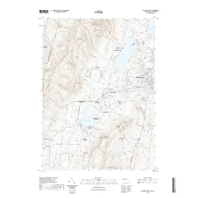
2021 Map of Pittsfield West
USGS Topo · Published 2021About this map
Hancock Shaker Village anchors the center of this map, reflecting the deep communal history of this borderland between New York and Massachusetts. The terrain is defined by the high ridges of the Taconic Range, including peaks like Tower Mtn and Doll Mtn, which drop down toward the industrial and civic center of Pittsfield. In the eastern section, the urban fabric is clear, showing landmarks such as the Berkshire County Superior Courthouse and several faith-based burial grounds including Saint Josephs Cem and Knesses Israel Cem. The landscape transitions from the dense street grids near Onota Lake to the scattered settlements of Barkerville and Sleepy Hollow. Aviation and education are represented by the Pittsfield Municipal Airport and Berkshire Community College, while extensive hiking networks like the Taconic Skyline Trl trace the western heights.
Find a feature on this map
195 named features on this map. Tap any name to fly to it.
Don’t see what you’re looking for? This feature index may not catch every label — zoom into the map to look around manually.
Map Details
Editions of this 2021 Pittsfield West Map
This is the sole edition of this map. No revisions or reprints were ever made.
Other maps of this area

1886 · Greylock
USGS Topo · 1:62,500

1886 · Becket
USGS Topo · 1:62,500

1888 · Becket
USGS Topo · 1:62,500

1888 · Berlin
USGS Topo · 1:62,500

1888 · Pittsfield
USGS Topo · 1:62,500

1890 · Pittsfield
USGS Topo · 1:62,500

1890 · Berlin
USGS Topo · 1:62,500

1891 · Greylock
USGS Topo · 1:62,500

1893 · Becket
USGS Topo · 1:62,500

1893 · Greylock
USGS Topo · 1:62,500