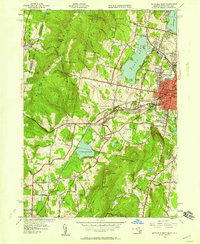
1944 Map of Pittsfield West
USGS Topo · Published 1958About this map
The western outskirts of Pittsfield and the rolling Berkshire landscape are defined by a mix of early industrial clusters and established community sites in the mid-1940s. Heavy transportation corridors like the Boston and Albany and the New York Central railroads cut through the terrain, connecting small settlements like Barkerville and West Pittsfield. Local heritage is anchored by significant sites such as the historic Shaker Village and the large recreational and civic spaces of Onota Lake and Wahconah Park.
Find a feature on this map
56 named features on this map. Tap any name to fly to it.
Don’t see what you’re looking for? This feature index may not catch every label — zoom into the map to look around manually.
Map Details
Editions of this 1944 Pittsfield West Map
This is the sole edition of this map. No revisions or reprints were ever made.
Other maps of this area

1886 · Greylock
USGS Topo · 1:62,500

1886 · Becket
USGS Topo · 1:62,500

1888 · Becket
USGS Topo · 1:62,500

1888 · Berlin
USGS Topo · 1:62,500

1888 · Pittsfield
USGS Topo · 1:62,500

1890 · Pittsfield
USGS Topo · 1:62,500

1890 · Berlin
USGS Topo · 1:62,500

1891 · Greylock
USGS Topo · 1:62,500

1893 · Becket
USGS Topo · 1:62,500

1893 · Greylock
USGS Topo · 1:62,500