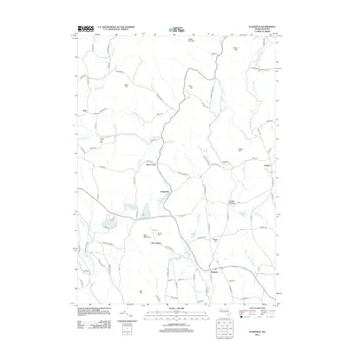
2012 Map of Plainfield
USGS Topo · Published 2012About this map
Plainfield and its surrounding hill towns occupy this area of the Berkshire foothills, where the landscape is defined by the high divides between the Chickley River and the northern branches of the Westfield River. Several small settlements and crossroads are identified across the terrain, including West Hawley, Hallockville, and Brier. The map documents early regional history through family-named landmarks like Allis Cem and Brier Cem, alongside geographic features such as Forge Hill and Warner Hill. Significant water bodies like Plainfield Pond and Hallockville Pond sit amidst a network of secondary roads, including Horton Rd and Plainfield Bush Rd, reflecting a rural character that has persisted into the modern era.
Find a feature on this map
111 named features on this map. Tap any name to fly to it.
Don’t see what you’re looking for? This feature index may not catch every label — zoom into the map to look around manually.
Map Details
Editions of this 2012 Plainfield Map
This is the sole edition of this map. No revisions or reprints were ever made.
Other maps of this area

1886 · Greylock
USGS Topo · 1:62,500

1886 · Hawley
USGS Topo · 1:62,500

1886 · Chesterfield
USGS Topo · 1:62,500

1886 · Becket
USGS Topo · 1:62,500

1888 · Becket
USGS Topo · 1:62,500

1888 · Chesterfield
USGS Topo · 1:62,500

1890 · Hawley
USGS Topo · 1:62,500

1891 · Greylock
USGS Topo · 1:62,500

1893 · Chesterfield
USGS Topo · 1:62,500

1893 · Becket
USGS Topo · 1:62,500