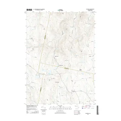
2015 Map of Plainfield
USGS Topo · Published 2015About this map
Plainfield and its surrounding hill towns occupy a high, brook-carved plateau where the boundaries of Berkshire, Franklin, and Hampshire counties converge. This 2015 U.S. Geological Survey representation reveals a landscape defined by water and topography, from the Chickley River in the north to the Westfield River at the southern edge. The distribution of settlements like West Hawley and Hallockville follows the valley floors and established ridge roads, while family and local history is anchored by sites such as Allis Cem near Bond Hill. The map illustrates the region's managed water resources, including the Nemasket River Reservoir and the recreational waters of Plainfield Pond. Large tracts of forest and significant elevations like Hawks Mtn and West Mtn suggest a modern era of conservation and low-density rural living in this corner of the Berkshires.
Find a feature on this map
100 named features on this map. Tap any name to fly to it.
Don’t see what you’re looking for? This feature index may not catch every label — zoom into the map to look around manually.
Map Details
Editions of this 2015 Plainfield Map
This is the sole edition of this map. No revisions or reprints were ever made.
Other maps of this area

1886 · Greylock
USGS Topo · 1:62,500

1886 · Hawley
USGS Topo · 1:62,500

1886 · Chesterfield
USGS Topo · 1:62,500

1886 · Becket
USGS Topo · 1:62,500

1888 · Becket
USGS Topo · 1:62,500

1888 · Chesterfield
USGS Topo · 1:62,500

1890 · Hawley
USGS Topo · 1:62,500

1891 · Greylock
USGS Topo · 1:62,500

1893 · Chesterfield
USGS Topo · 1:62,500

1893 · Becket
USGS Topo · 1:62,500