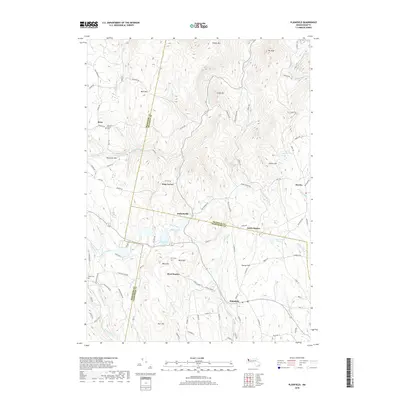
2018 Map of Plainfield
USGS Topo · Published 2018About this map
Plainfield occupies the high ground of the Berkshire foothills, where the headwaters of the Westfield River and the Chickley River diverge across a landscape defined by historical hill farms and small forest settlements. The village center at Plainfield connects via Hallockville Rd to the cluster at Hallockville, where the Hallockville Pond sits near the crossing of the Franklin and Hampshire county line. This upland region is notable for its preserved family burial grounds, including the Allis Cem near Bond Hill and the Spruce Corner Cem in the northwestern hamlet of Brier. The terrain is deeply incised by brooks such as Phelps Brook and Tower Brook, which feed into the larger river systems. Genealogists can trace old family names through landmarks like Warner Hill, Parker Hill, and the isolated settlement at King Corner, reflecting the 19th-century agricultural and timber economy that shaped these mountain towns.
Find a feature on this map
107 named features on this map. Tap any name to fly to it.
Don’t see what you’re looking for? This feature index may not catch every label — zoom into the map to look around manually.
Map Details
Editions of this 2018 Plainfield Map
This is the sole edition of this map. No revisions or reprints were ever made.
Other maps of this area

1886 · Greylock
USGS Topo · 1:62,500

1886 · Hawley
USGS Topo · 1:62,500

1886 · Chesterfield
USGS Topo · 1:62,500

1886 · Becket
USGS Topo · 1:62,500

1888 · Becket
USGS Topo · 1:62,500

1888 · Chesterfield
USGS Topo · 1:62,500

1890 · Hawley
USGS Topo · 1:62,500

1891 · Greylock
USGS Topo · 1:62,500

1893 · Chesterfield
USGS Topo · 1:62,500

1893 · Becket
USGS Topo · 1:62,500