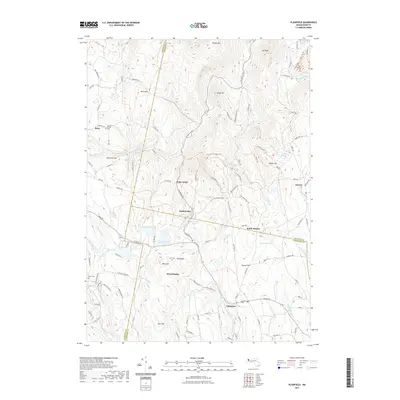
2021 Map of Plainfield
USGS Topo · Published 2021About this map
Plainfield serves as a central hub in this high-elevation corner of the Massachusetts Berkshires, where the Westfield River and Chickley River headwaters carve through the plateau. The landscape is defined by its numerous family-named peaks and clear water bodies, including Crooked Pond, Plainfield Pond, and Hallockville Pond. Small settlements like Hallockville, West Hawley, and South Hawley are scattered along winding routes such as Hallockville Rd and W Main St.
Find a feature on this map
133 named features on this map. Tap any name to fly to it.
Don’t see what you’re looking for? This feature index may not catch every label — zoom into the map to look around manually.
Map Details
Editions of this 2021 Plainfield Map
This is the sole edition of this map. No revisions or reprints were ever made.
Other maps of this area

1886 · Greylock
USGS Topo · 1:62,500

1886 · Hawley
USGS Topo · 1:62,500

1886 · Chesterfield
USGS Topo · 1:62,500

1886 · Becket
USGS Topo · 1:62,500

1888 · Becket
USGS Topo · 1:62,500

1888 · Chesterfield
USGS Topo · 1:62,500

1890 · Hawley
USGS Topo · 1:62,500

1891 · Greylock
USGS Topo · 1:62,500

1893 · Chesterfield
USGS Topo · 1:62,500

1893 · Becket
USGS Topo · 1:62,500