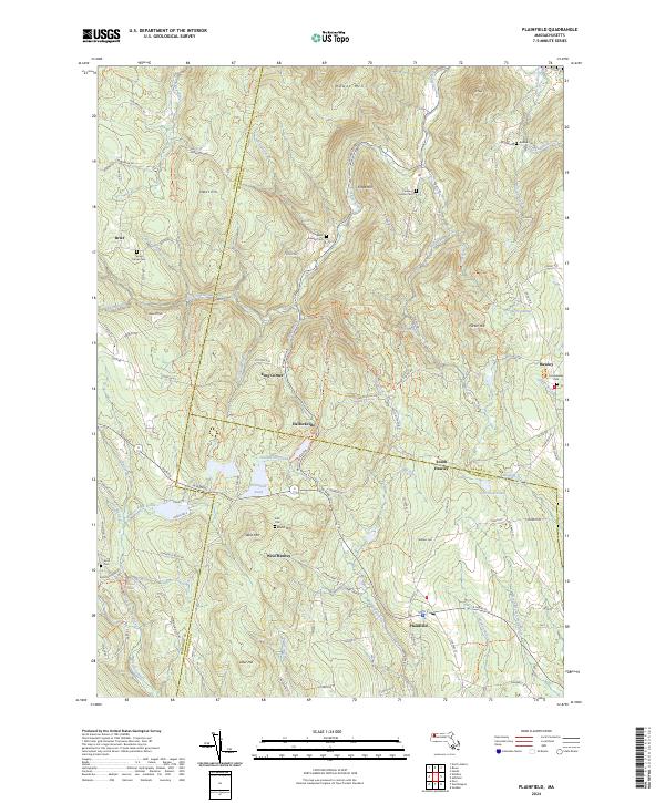
2024 Map of Plainfield
USGS Topo · Published 2024About this map
The Chickley River and Swift River drainage basins carve through the high elevations of the northern Berkshires on this contemporary survey. Small mountain settlements such as Hallockville, Brier, and West Hawley are documented alongside numerous family and community cemeteries, including Allis Cem and Pudding Hollow Cem, which offer significant value for genealogical research in this rural pocket of Franklin County. The terrain is defined by prominent peaks like Hawks Mtn and Deer Hill, separated by a complex network of brooks and hollows.
Find a feature on this map
126 named features on this map. Tap any name to fly to it.
Don’t see what you’re looking for? This feature index may not catch every label — zoom into the map to look around manually.
Map Details
Editions of this 2024 Plainfield Map
This is the sole edition of this map. No revisions or reprints were ever made.
Other maps of this area

1886 · Greylock
USGS Topo · 1:62,500

1886 · Hawley
USGS Topo · 1:62,500

1886 · Chesterfield
USGS Topo · 1:62,500

1886 · Becket
USGS Topo · 1:62,500

1888 · Becket
USGS Topo · 1:62,500

1888 · Chesterfield
USGS Topo · 1:62,500

1890 · Hawley
USGS Topo · 1:62,500

1891 · Greylock
USGS Topo · 1:62,500

1893 · Chesterfield
USGS Topo · 1:62,500

1893 · Becket
USGS Topo · 1:62,500