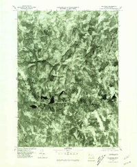
1975 Map of Plainfield
USGS Topo · Published 1981About this map
Plainfield and the surrounding hill country of western Massachusetts are documented here through high-altitude aerial photography. This orthophotoquad reveals the dense forest canopy and scattered rural clearings of the mid-1970s, showcasing a landscape defined by its river systems and small settlements. The Chickley River carves a winding path through the northern terrain toward West Hawley, while the Westfield River skirts the southwestern corner of the sheet. For local historians, the map provides a precise spatial record of hamlets like Hawley and Brier, as well as named intersections such as King Corner. The presence of Windsor Pond highlights the area's natural hydrology, which has long influenced the placement of roads and farmsteads in this corner of the Commonwealth.
Find a feature on this map
8 named features on this map. Tap any name to fly to it.
Don’t see what you’re looking for? This feature index may not catch every label — zoom into the map to look around manually.
Map Details
Editions of this 1975 Plainfield Map
This is the sole edition of this map. No revisions or reprints were ever made.
Other maps of this area

1886 · Greylock
USGS Topo · 1:62,500

1886 · Hawley
USGS Topo · 1:62,500

1886 · Chesterfield
USGS Topo · 1:62,500

1886 · Becket
USGS Topo · 1:62,500

1888 · Becket
USGS Topo · 1:62,500

1888 · Chesterfield
USGS Topo · 1:62,500

1890 · Hawley
USGS Topo · 1:62,500

1891 · Greylock
USGS Topo · 1:62,500

1893 · Chesterfield
USGS Topo · 1:62,500

1893 · Becket
USGS Topo · 1:62,500