2024 Map of Pleasant Plains
USGS Topo · Published 2024About this map
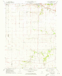
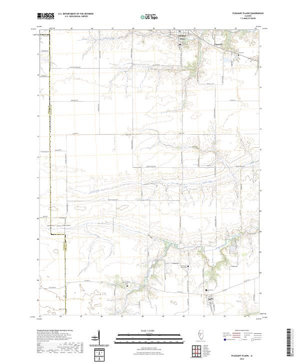
Pleasant Plains and the village of Berlin anchor this agricultural landscape in western Sangamon County, reflecting a pattern of prairie settlement defined by rural cemeteries and farm-to-market roads. The terrain is bisected by the drainages of Richland Creek, Prairie Creek, and Spring Creek, which create natural breaks in the rectangular survey grid. For family historians, the map is a dense record of local burial grounds, including the Old Mount Zion Cem, Wood Wreath Cem, and Irwin Cem. The boundary between Morgan Co and Sangamon Co runs along the western edge, while transportation history is visible in the alignment of Old State Rd and the presence of Smith Airport. This 2024 survey captures the persistence of these small Illinois communities as they maintain their identities amidst the surrounding grain fields and creek bottoms.
Find a feature on this map
63 named features on this map. Tap any name to fly to it.
Don’t see what you’re looking for? This feature index may not catch every label — zoom into the map to look around manually.
Map Details
Editions of this 2024 Pleasant Plains Map
This is the sole edition of this map. No revisions or reprints were ever made.