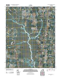
2011 Map of Pleasant Ridge
USGS Topo · Published 2011About this map
Princess Anne and the surrounding hamlets of south Virginia Beach define this coastal plain landscape where the North Landing River serves as a primary geographical axis. The map documents the low-lying terrain interlaced with water bodies like the Pocaty River and West Neck Creek, which connect several small landings and crossroads settlements. These established community centers, including Pungo and Dawley Corners, are linked by long-standing transit corridors such as Princess Anne Rd and Indian River Rd. In the southeastern portion of the map, the Back Bay Station Virginia Beach Post Office and the Charity Cemetery serve as landmarks for genealogists and local historians. The density of named creeks and marshes, including Beggers Bridge Creek and Nauney Creek, illustrates the hydraulic complexity of this region near the North Carolina border.
Find a feature on this map
53 named features on this map. Tap any name to fly to it.
Don’t see what you’re looking for? This feature index may not catch every label — zoom into the map to look around manually.
Map Details
Editions of this 2011 Pleasant Ridge Map
This is the sole edition of this map. No revisions or reprints were ever made.
Other maps of this area

1893 · Virginia Beach
USGS Topo · 1:125,000

1907 · Norfolk
USGS Topo · 1:125,000

1916 · Back Bay
USGS Topo · 1:62,500

1918 · Cape Henry
USGS Topo · 1:62,500

1919 · Cape Henry
USGS Topo · 1:62,500

1939 · Moyock
USGS Topo · 1:62,500

1943 · Back Bay
USGS Topo · 1:62,500

1946 · Moyock
USGS Topo · 1:62,500

1946 · Eastville
USGS Topo · 1:250,000

1946 · Currituck Sound
USGS Topo · 1:250,000