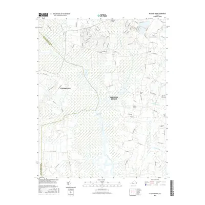
2016 Map of Pleasant Ridge
USGS Topo · Published 2016About this map
Princess Anne and the surrounding coastal lowlands of Virginia's Atlantic frontier are defined here by a complex network of wetlands and tidal waters. The North Landing River serves as a central artery for the region, carrying the Intracoastal Waterway through a landscape of extensive marshes such as Gum Swamp. This area maintains a distinct rural character, with scattered settlements like Pungo and Pleasant Ridge standing as long-established communities amidst a web of drainage creeks including West Neck Creek and Nawney Creek.
Find a feature on this map
89 named features on this map. Tap any name to fly to it.
Don’t see what you’re looking for? This feature index may not catch every label — zoom into the map to look around manually.
Map Details
Editions of this 2016 Pleasant Ridge Map
This is the sole edition of this map. No revisions or reprints were ever made.
Other maps of this area

1893 · Virginia Beach
USGS Topo · 1:125,000

1907 · Norfolk
USGS Topo · 1:125,000

1916 · Back Bay
USGS Topo · 1:62,500

1918 · Cape Henry
USGS Topo · 1:62,500

1919 · Cape Henry
USGS Topo · 1:62,500

1939 · Moyock
USGS Topo · 1:62,500

1943 · Back Bay
USGS Topo · 1:62,500

1946 · Moyock
USGS Topo · 1:62,500

1946 · Eastville
USGS Topo · 1:250,000

1946 · Currituck Sound
USGS Topo · 1:250,000