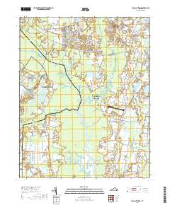
2019 Map of Pleasant Ridge
USGS Topo · Published 2019About this map
The North Landing River defines the central axis of this landscape, carving through the low-lying wetlands that separate Chesapeake and Virginia Beach. This maritime corridor serves as a critical leg of the Intracoastal Waterway, where the natural flow of Canoe Creek and the Pocaty River meet modern transit needs. On the eastern side of the river, the landscape transitions to the higher ground of the Atlantic Coastal Plain, marked by traditional rural settlements like Pungo and Charity Neck. Historical sites such as the Charity United Methodist Church Cem provide a genealogical anchor for the community, while the Virginia Beach Airport highlights the region's continued importance for local aviation. The intricate network of smaller tributaries, including Beggars Bridge Cr and West Neck Creek, illustrates the complex drainage patterns essential to the area's agricultural and residential development.
Find a feature on this map
96 named features on this map. Tap any name to fly to it.
Don’t see what you’re looking for? This feature index may not catch every label — zoom into the map to look around manually.
Map Details
Editions of this 2019 Pleasant Ridge Map
This is the sole edition of this map. No revisions or reprints were ever made.
Other maps of this area

1893 · Virginia Beach
USGS Topo · 1:125,000

1907 · Norfolk
USGS Topo · 1:125,000

1916 · Back Bay
USGS Topo · 1:62,500

1918 · Cape Henry
USGS Topo · 1:62,500

1919 · Cape Henry
USGS Topo · 1:62,500

1939 · Moyock
USGS Topo · 1:62,500

1943 · Back Bay
USGS Topo · 1:62,500

1946 · Moyock
USGS Topo · 1:62,500

1946 · Eastville
USGS Topo · 1:250,000

1946 · Currituck Sound
USGS Topo · 1:250,000