2022 Map of Pleasanton
USGS Topo · Published 2022About this map
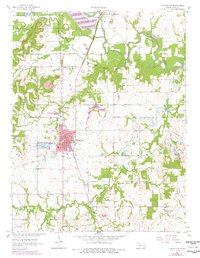
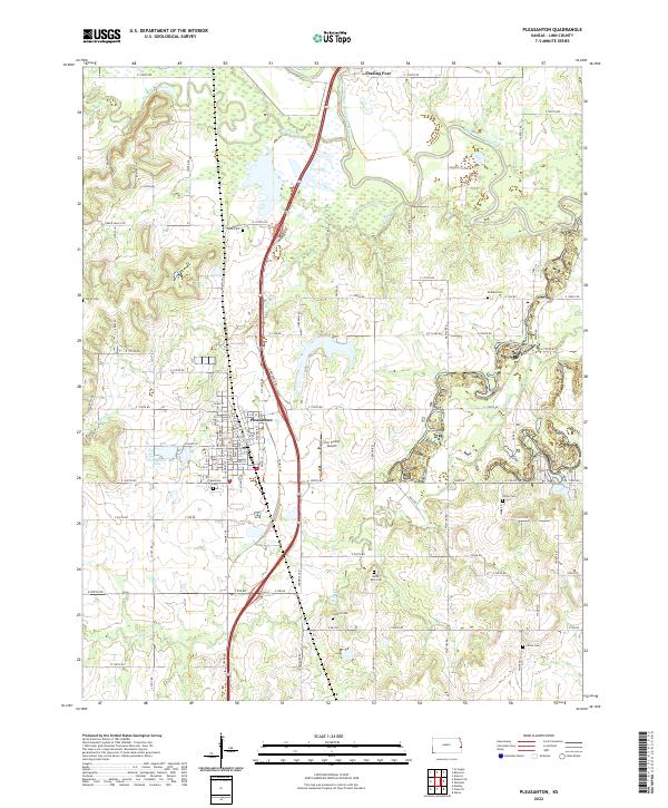
Trading Post and Pleasanton anchor this eastern Kansas landscape, where the meandering course of the Marais des Cygnes River dictates the local topography. This 2022 survey illustrates a region defined by its water systems, including Big Sugar Cr, Little Sugar Cr, and the branching tributaries of Mine Cr. The settlement pattern follows both the historical river crossings and the modern corridor of the north-south highway, providing a clear view of how transit has evolved in Linn County.
Find a feature on this map
87 named features on this map. Tap any name to fly to it.
Don’t see what you’re looking for? This feature index may not catch every label — zoom into the map to look around manually.
Map Details
Editions of this 2022 Pleasanton Map
This is the sole edition of this map. No revisions or reprints were ever made.