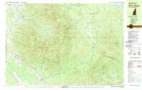
1982 Map of Pliny Range
USGS Topo · Published 1983About this map
White Mountain National Forest dominates this topographic survey, covering the prominent peaks of the Pliny Range and Pilot Range. High-elevation landmarks such as Mt Waumbek and Mt Starr King overlook the scattered mountain settlements in the valleys below. The small community of Jefferson is anchored by the Forest Vale Cem and local religious centers like St Johns Ch.
Find a feature on this map
63 named features on this map. Tap any name to fly to it.
Don’t see what you’re looking for? This feature index may not catch every label — zoom into the map to look around manually.
Map Details
Editions of this 1982 Pliny Range Map
This is the sole edition of this map. No revisions or reprints were ever made.
Other maps of this area

1893 · Mt. Washington
USGS Topo · 1:62,500

1893 · Gorham
USGS Topo · 1:62,500

1896 · Mt. Washington
USGS Topo · 1:62,500

1896 · Gorham
USGS Topo · 1:62,500

1900 · Whitefield
USGS Topo · 1:62,500

1920 · Guildhall
USGS Topo · 1:62,500

1930 · Milan
USGS Topo · 1:62,500

1930 · Percy
USGS Topo · 1:62,500

1931 · Guildhall
USGS Topo · 1:48,000

1933 · Guildhall
USGS Topo · 1:48,000